Fire Risk Analysis Made Simple. Just Drop a Pin.
Instantly Understand & Control Wildfire Risk, Anywhere.
Wildfire threats are increasing—but planning and managing fire risk shouldn’t be complicated or slow. With FireSafe’s fire risk analysis platform, receive risk scores and detailed reports, generated instantly. Unlock layered, real-time insights that help you protect people, property, and critical resources. From fuel density, ground moisture, water sources, fire stations, population density, and more…. Hundreds of data sets are combined through the FireSafe Intelligence hub™ for an accurate Wildfire Risk Report.
Our easy-to-use dashboard puts next-generation analytics, drone mapping, and live risk intelligence at your fingertips. Make smarter decisions in seconds—not hours—with the most intuitive fire risk analysis solution available today.
All-In-One Solution
Why Choose FireSafe for Fire Risk Analysis?
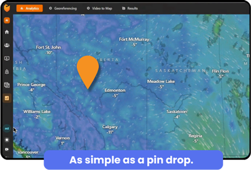
As Simple as a Pin Drop
Drop a pin, get a risk score. Instantly visualize wildfire risk for any location—no training or technical background required.
See the Big Picture
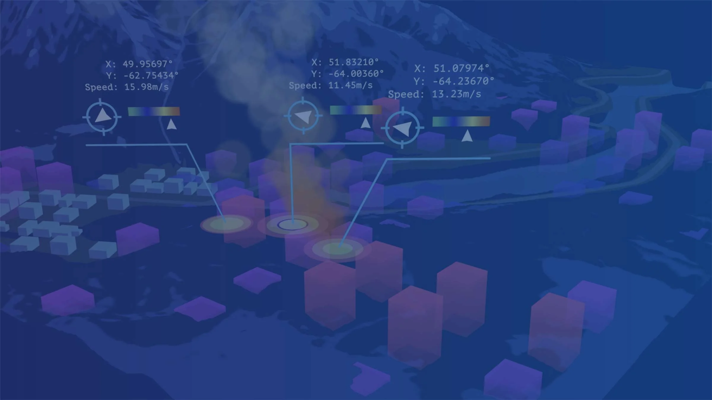
Unified dashboard displays risk maps, camera feeds, weather, historical fire paths, and more—all in one place.
Share & Collaborate
Easily export, print, or share interactive risk maps with your team or across departments.
Hyperspectral Satellite Imagery
Use a hyperspectral picture from space through our partner Wyvern for up to date Risk Analysis
Current Map Data through Drone Imagery
Upload Drone footage for current, precise and up to date wildfire fuel data.
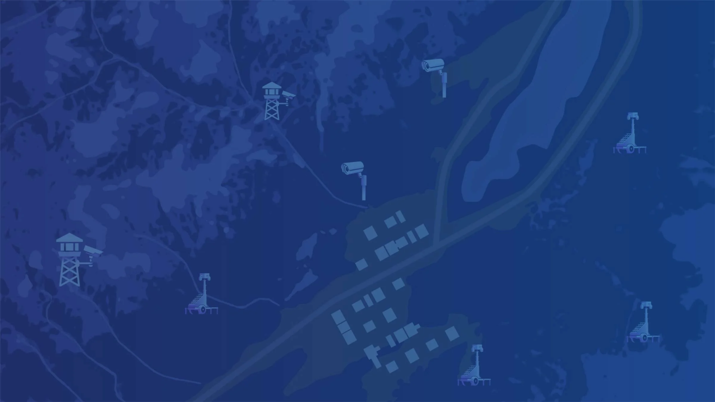
Live Monitoring & AI Alerts
Real-time updates from cameras, sensors, and drones keep you ahead of emerging risks.
How it Works
Analyze Fire Risk in Seconds.
Step 1: Open the FireSafe dashboard and drop a pin anywhere on the map. It’s that easy!
Step 2: See instant fire risk scores based on live data, local weather, past incidents, terrain, and more.
Step 3: Get alerts, predictive modeling, and ongoing updates—so you always know what’s changing, and where to act.
Optionally layer in live camera feeds, hyperspectral satellite or drone imagery for updated details.
Drone-Powered Fire Risk Mapping
Drone integration for precise fire risk analysis possible.
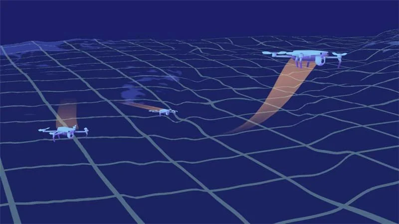
FireSafe integrates seamlessly with drone and aerial footage - giving you high-resolution risk maps, historical change tracking, and post-fire assessments.
Upload your own drone or aircraft images, or use FireSafe’s drone partners for on-demand AI analysis anywhere you need it.
Map fuel breaks, vulnerable areas, and access routes.
3cm resolution for neighborhood or parcel-level risk scoring.
Overlay risk zones, vegetation dryness, and infrastructure data.
Track changes pre- and post-burn for reporting and compliance.
Unlock Next-Level Insight with Satellite Hyperspectral Imagery.
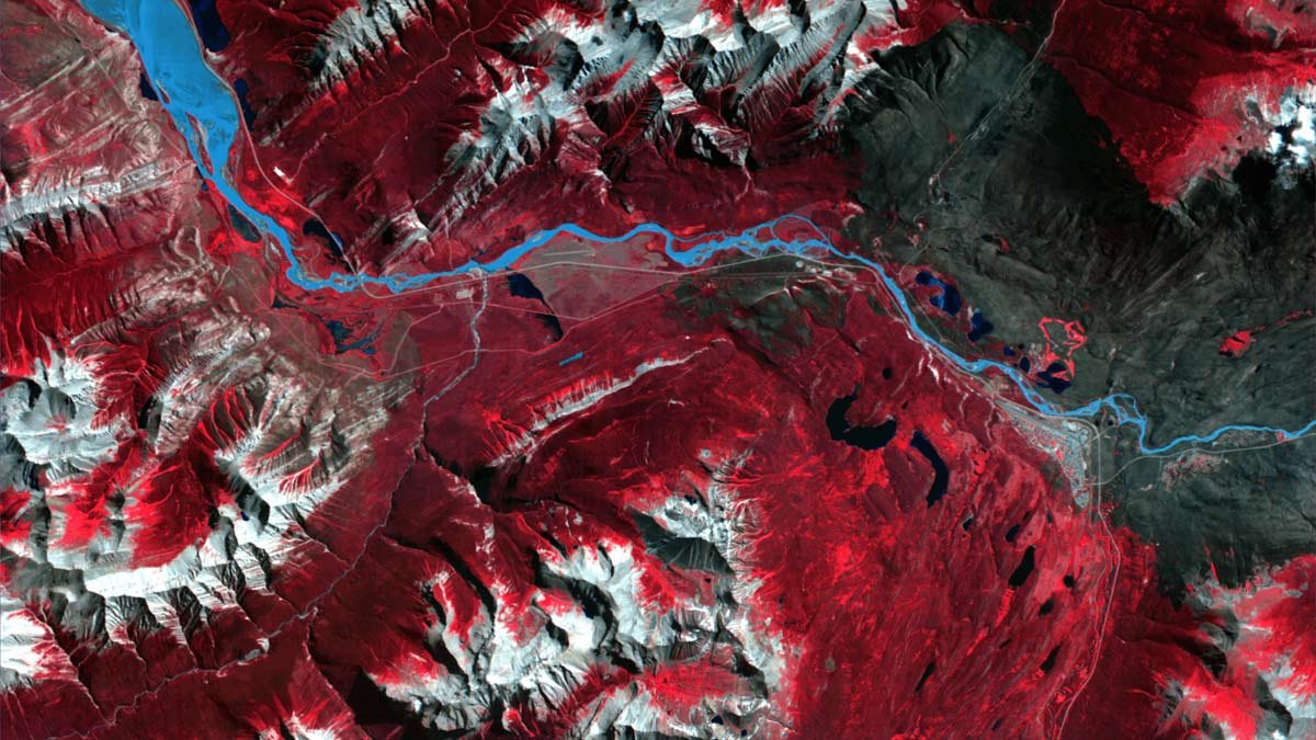
See what others miss: Move beyond outdated satellite images with the latest hyperspectral technology powered by our partner, Wyvern.
Most wildfire risk analyses and environmental monitoring still rely on old or limited satellite data, which often means missing crucial changes on the ground. Hyperspectral satellite imagery is a breakthrough: Unlike traditional photos or even standard multispectral satellites, hyperspectral sensors capture 10x more detail, revealing subtle differences in vegetation, dryness, soil, and potential wildfire risk—down to the species level in mixed forests.
What does this mean for you?
Faster, Smarter Detection: Spot early warning signs and changing risk zones that older satellite imagery simply can’t catch.
Pinpoint Accuracy: Make better decisions with ultra-precise details—know not just where risk is, but exactly what’s causing it.
Always Up-to-Date: Access the most current imagery, so you’re never working with stale or incomplete data.
Seamless Integration: Hyperspectral data works directly within FireSafe’s dashboard—combining seamlessly with your camera, drone, and sensor feeds for a full, real-time picture.
With Wyvern’s hyperspectral satellites and FireSafe’s intelligent platform, you get the complete story—helping you protect people, property, and resources with confidence.
Video Overview
See How FireSafe Works
Want to know how FireSafe transforms wildfire detection and response? Watch our quick overview video to discover how our unified, intelligent system delivers real-time alerts, predictive modeling, and seamless integration—helping you protect what matters most. Click below to see FireSafe’s impact for yourself!
FireSafe gives you the clarity and confidence to manage wildfire risk proactively.
Whether you’re a city planner, emergency manager, fire service, or asset protection manager, FireSafe is designed as a flexible solution that can be tailored to your needs.
Insurance
Elevate your insurance policy with a detailed analysis report. Understand how mitigation strategies increase your score.
Corporations & Utilities
Secure critical assets by monitoring fire risk on facility grounds, transmission corridors, and access points.
Government Agencies
Manage regional fire response, plan prevention strategies, and fulfill regulatory reporting requirements.
See How Easy Fire Risk Analysis Can Be.
Experience the fastest, simplest way to assess and act on fire risk—wherever you work.