
Wildfire Predictive Modeling - Forecast the Speed and Direction of Wildfire.
Smarter Wildfire Predictive Modeling Made Simple.
Wildfires are evolving—so should your approach to prevention. FireSafe combines cutting-edge wildfire modeling software with predictive analysis, making it easier than ever for municipalities and agencies to predict, prepare, and protect. In just a couple of clicks, you’ll have access to real-time risk insights, predictive simulations, and actionable preventive measure solutions—all in a platform as intuitive as your favorite mapping apps.
Video Overview
See FireSafe in Action
Want to see how easy wildfire modeling and monitoring can be? Watch our overview video for a quick demonstration of how FireSafe empowers teams to predict, prepare, and protect—right from your desktop or mobile device.
All-In-One Solution
Model, Monitor, and Respond—All in One Place
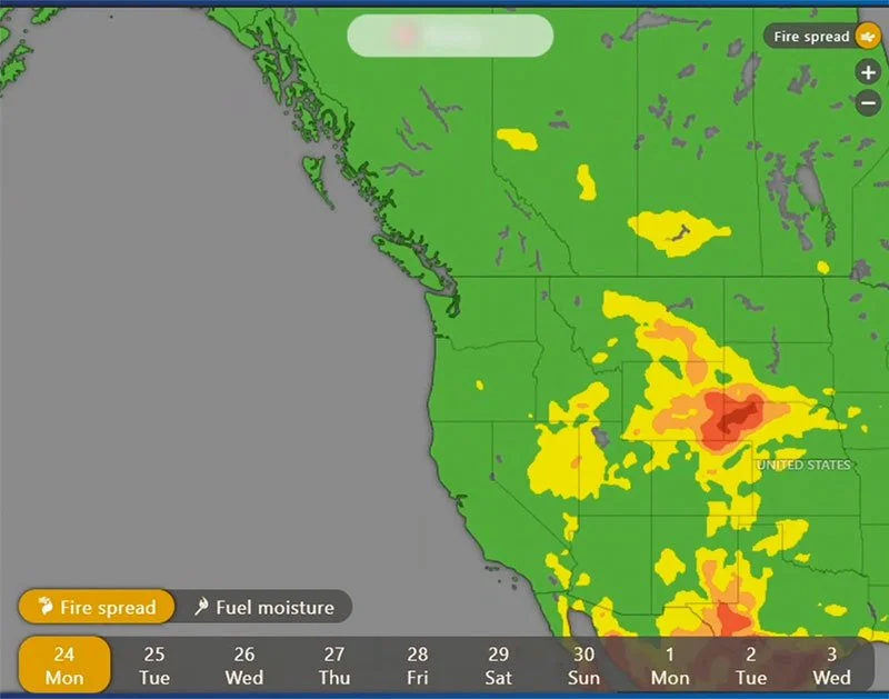
Wildfire Modeling Simulation
Run “what-if” scenarios in seconds to see how fires could spread, identify weak spots, and plan response strategies with confidence.
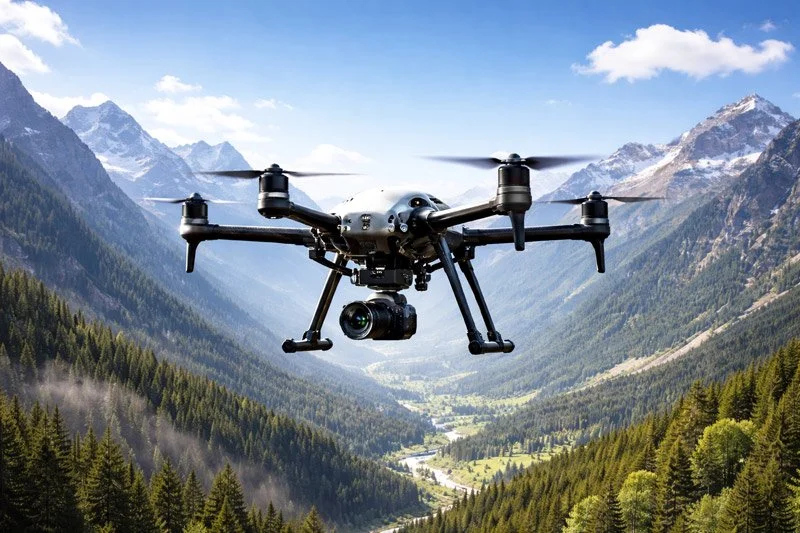
Drone Imagery
Tap into drone footage for the most current ground and fuel imagery allowing the FireSafe Intelligence Hub™ to display real time simulation.
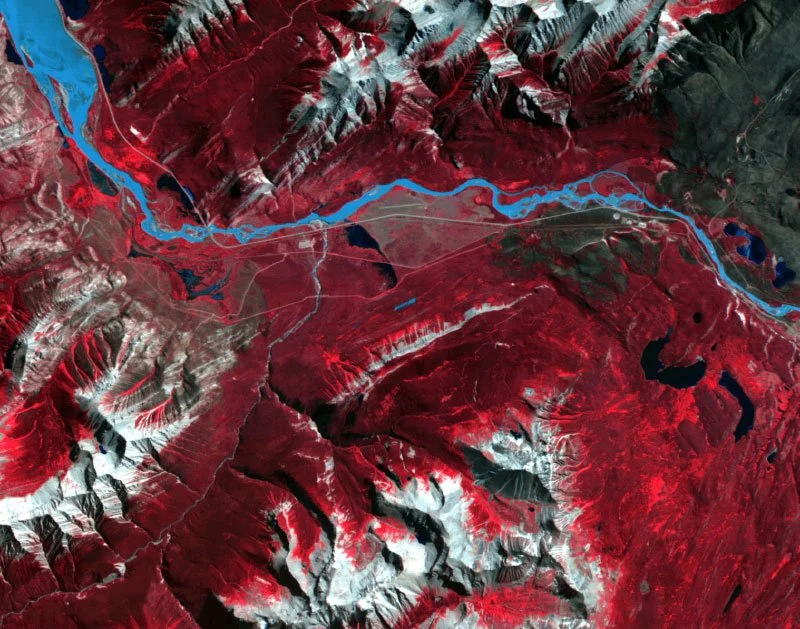
Satellite Imagery
Hyperspectral satellite data from our partner Wyvern helps assess vegetation and fuel risks, and validate post-burn recovery—all with AI-enhanced analysis.
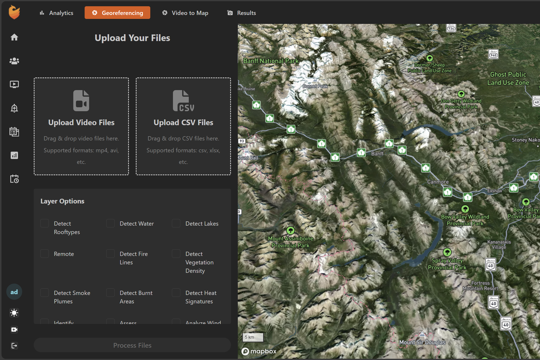
Collaborative Tools
User friendly dashboard allows for easy integration of client owned footage for up to date mapping. Upload video files and flight plans into our georeferencing system.
How it Works
Model, Monitor, and Respond—All in One Place
Everything you need to take charge of wildfire threats:
Wildfire Modeling Simulation: Run “what-if” scenarios in seconds to see how fires could spread, identify weak spots, and plan response strategies with confidence.
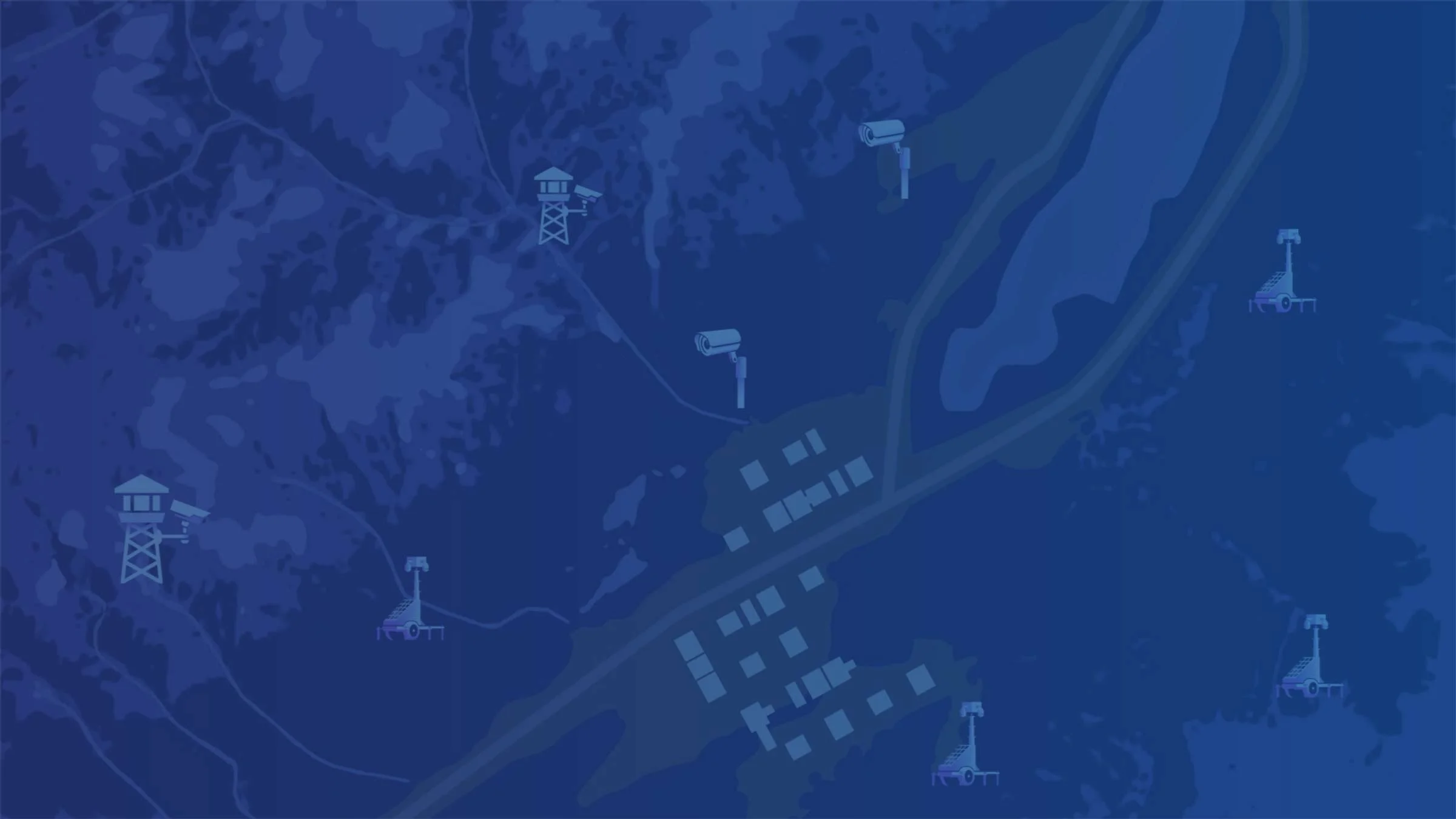
Real-Time Wildfire Monitoring: Tap into a unified network of cameras, drones, and mobile surveillance trailers, all connected to our cloud-based Intelligence Hub.
Drone Mapping & High-Resolution Insights: Launch drones to capture ultra-detailed imagery, assess vegetation and fuel risks, and validate post-burn recovery—all with AI-enhanced analysis.
Collaborative Tools: Share live dashboards and reports securely for seamless emergency coordination across agencies.
Turnkey Solutions
Advanced Wildfire Monitoring - FireSafe Intelligence Hub™
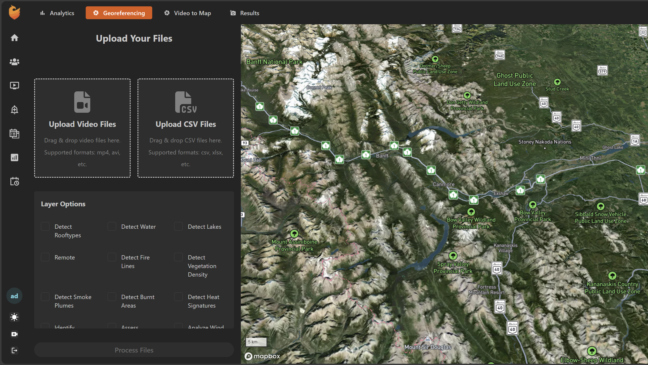
Client Owned Footage - Georeferencing
Upload video files and flight plans taken via drone or helicopter for the most up to date georeferenced imagery, allowing the FireSafe Intelligence Hub™ to utilize footage for fuel density, fuel type, ground moisture and more - This will create the most accurate Wildfire Modeling Simulation available.
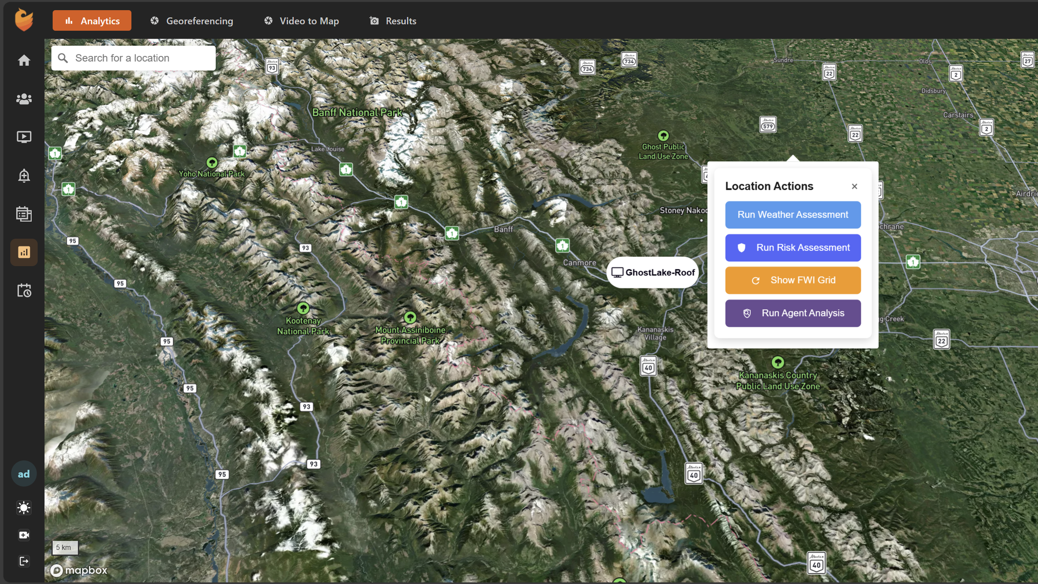
Advanced Analytics
Expand your current capabilities using the Analytics tools on the FireSafe Intelligence Hub™. Run your own Risk assessment or simulation at any time, allowing for actionable, time sensitive response. Use FireSafe’s wildfire analytics tools to optimize coverage and allocate budget for installation’s efficiently.
Why Municipalities and Organizations Choose FireSafe
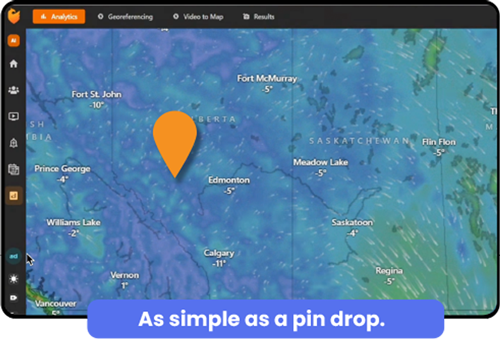
Simple, Intuitive Interface: Familiar map-based workflows—just drop a pin to get started.
Data-Driven Decisions: Unify wildfire intelligence and modeling for faster, smarter action.
Scalable & Reliable: Supports municipalities, utilities, and regional collaborations of any size.
Support and Training: Easy onboarding, 24/7 support, and comprehensive drone training are all available.
Flexible Plans to Suit Any Municipality or Department
Choose from rental, lease, or purchase options:
Rental
Seasonal or yearly access, low monthly fee, and full platform features included.
Lease
Scalable plans with maintenance and dynamic device pricing.
Purchase
Full ownership and customization plus unlimited access to analytics and dashboards.
AI Suite Subscription: Easy monthly annual license for always-updated AI analytics and detection tools.
Predict, Prepare & Protect.
Take the guesswork out of wildfire management. FireSafe's wildfire modeling software makes prevention as easy as dropping a pin.